MOUNTAIN BIKE PATAGONIA
Northern Patagonia
TOTAL ROUTE DISTANCE = 825 km
ROAD TYPE = 60% paved
COUNTRIES = Argentina & Chile
EXPLORE ROUTES AND STOPS IN NORTHERN PATAGONIA
Bariloche – Villa La Angostura – Lanin National Park – San Martin de Los Andes – Hua Hum Pass – Pucon – Huilo Huilo – Coyhaique – Puerto Río Tranquilo – Villa Cerro Castillo

MOUNTAIN BIKE CARRETERA AUSTRAL
TOTAL ROUTE DISTANCE = 1,247 km
ROAD TYPE = 60% gravel (ripio)
COUNTRIES Chile
EXPLORE ROUTES AND TOWNS ON THE CARRETERA AUSTRAL
Puerto Montt – Calbuco – Ensenada – Puerto Varas – La Junta – Futaleufú – Esquel (Argentina) –
Los Altares – Coyhaique (Chile) – Puerto Río Tranquilo – Villa Cerro Castillo – Villa O’Higgins
MOUNTAIN BIKE SOUTHERN PATAGONIA
TOTAL ROUTE DISTANCE = 1,400 km
ROAD TYPE = 75% paved
COUNTRIES = Argentina & Chile
EXPLORE ROUTES & TOWNS IN SOUTHERN PATAGONIA
Villa O’Higgins – El Chaltén – El Calafate – Cerro Castillo – Puerto Natales – Punta Arenas –
Río Grande – Tolhuin – Ushuaia

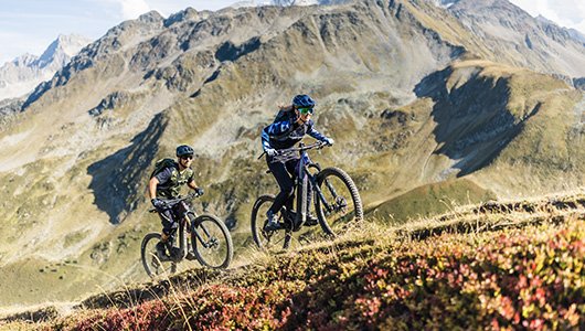
Mountain Biking in Northern Patagonia (Argentina and Chile) offers an unforgettable adventure through some of the most pristine and rugged landscapes in the world. The region is filled with diverse terrain—everything from rolling hills, dense forests, lakes, and snow-capped mountains to desert and steppes, making it an ideal area for mountain biking. Northern Patagonia is known for its raw, untouched beauty, with quiet roads, remote villages, and unforgettable views of volcanoes, glaciers, and rivers.
Below is a 10-day itinerary for an exciting mountain biking tour that crosses both Argentina and Chile, starting from the Lake District in Argentina and weaving through the Andes, before concluding in Chile’s Patagonia.
Day 1: Arrival in San Carlos de Bariloche, Argentina
Arrival: Fly into San Carlos de Bariloche, one of Argentina’s premier mountain biking destinations located in the heart of Patagonia.
Preparation: If you haven’t already, rent your mountain bike, check your gear, and get your bearings.
Evening: Explore Bariloche, famous for its Swiss-style architecture, chocolate shops, and breathtaking views of Lake Nahuel Huapi and the Andes. Take a gentle ride around the lake or hike up to Cerro Campanario for panoramic views.
Day 2: San Carlos de Bariloche to Villa La Angostura
Distance: 85 km / 53 miles
Cycling: Depart Bariloche and head towards Villa La Angostura, cycling along the scenic Ruta de los Siete Lagos (Seven Lakes Road). This route is famous for its stunning lakes, mountain views, and dense forests.
Highlights: Ride through picturesque forests, with clear lakes like Lago Correntoso and Lago Espejo on either side. Expect some technical climbs and descents as you cycle through the Andean foothills.
Evening: Stay in Villa La Angostura, a charming lakeside town with access to nearby forests and mountains.
Day 3: Villa La Angostura to Lanín National Park
Distance: 100 km / 62 miles
Cycling: Cycle from Villa La Angostura into Lanín National Park, crossing into Argentina’s Neuquén Province. The route winds through the park, known for its volcanic landscape, native forests, and views of Mount Lanín.
The terrain will be a mix of gravel paths and some paved roads, with varied elevation.
Highlights: Enjoy views of Mount Lanín, Lago Huechulafquen, and the wild beauty of Patagonia’s wilderness. This route is more remote, so prepare for long stretches without services.
Evening: Camp in Lanín National Park or stay at a mountain lodge in the park.
Day 4: Lanín National Park to San Martín de los Andes
Distance: 80 km / 50 miles
Cycling: Ride from Lanín National Park to San Martín de los Andes, a beautiful town located on the shores of Lake Lacar. This route offers diverse terrain, including forested paths and alpine lakes.
The final stretch is more challenging as you approach San Martín de los Andes, with steep climbs and rugged mountain scenery.
Highlights: Views of Lake Lacar, forest trails, and glimpses of the Andes. San Martín de los Andes itself is a picture-perfect town.
Evening: Stay in San Martín de los Andes, enjoy local cuisine, or explore the town’s charming streets.
Day 5: San Martín de los Andes to Hua Hum Pass
Distance: 80 km / 50 miles
Cycling: Ride from San Martín de los Andes to the Hua Hum Pass, which marks the border between Argentina and Chile. The route takes you through the Patagonian steppe and offers panoramic views of snow-capped mountains.
The first part of the route is characterized by mountainous terrain before you begin the descent toward the pass.
Highlights: Enjoy the ride through Andean valleys, with expansive views of Lago Hua Hum and surrounding mountains. Cross into Chile at the border post.
Evening: Stay in a small border town like Villa Pehuenia or Puerto Hua Hum, which offers simple accommodations in a peaceful setting.
Day 6: Hua Hum Pass to Pucon, Chile
Distance: 110 km / 68 miles
Cycling: Ride through Chile and head towards Pucón, a famous adventure town located near Volcán Villarrica.
This section includes riding along rivers, volcanic valleys, and the base of Volcán Villarrica. Prepare for moderate climbs, especially as you get closer to the volcano.
Highlights: Volcán Villarrica, lakes, and the nearby Huilo Huilo Biological Reserve. The town of Pucón itself offers plenty of adventure options, including hot springs, rafting, and hiking.
Evening: Enjoy the atmosphere of Pucón and unwind after a challenging day.
Day 7: Pucón to Huilo Huilo Biological Reserve
Distance: 60 km / 37 miles
Cycling: Head to the Huilo Huilo Biological Reserve, a massive nature reserve that is home to rainforests, waterfalls, and incredible wildlife.
The route is relatively short but includes some tough ascents and technical trails. The reward is riding through one of Patagonia’s most biodiverse areas.
Highlights: Huilo Huilo Falls, dense temperate rainforest, and volcanic landscapes. The reserve is a paradise for nature lovers.
Evening: Stay at an eco-lodge or cabin in the Huilo Huilo Reserve, surrounded by pristine nature.
Day 8: Huilo Huilo to Coyhaique
Distance: 140 km / 87 miles
Cycling: This is one of the longest and most challenging days, as you’ll be riding from the Huilo Huilo Reserve to Coyhaique, the capital of Aysén Region in Chile. The road to Coyhaique offers spectacular views of the Patagonian Andes and remote valleys.
Prepare for gravel roads, ascents, and descents as you cross rivers and ride through the Patagonian steppe.
Highlights: Views of the Andes Mountains, glaciers, and Patagonian wilderness. As you approach Coyhaique, the landscape turns to rugged foothills and valleys.
Evening: Stay in Coyhaique, explore the town, and prepare for the next leg of your journey.
Day 9: Coyhaique to Puerto Río Tranquilo
Distance: 130 km / 81 miles
Cycling: Ride from Coyhaique to Puerto Río Tranquilo, a small village on the shores of Lake General Carrera. The route will pass through dense forests, glacial rivers, and remote valleys.
Expect steep climbs and winding roads as you get closer to the lake. The reward is breathtaking views of glacial lakes and rugged mountains.
Highlights: Lake General Carrera, Patagonian fjords, and the stunning Marble Caves. Puerto Río Tranquilo is a remote and peaceful destination.
Evening: Relax by the lake, perhaps even take a boat trip to the Marble Caves.
Day 10: Puerto Río Tranquilo to Villa Cerro Castillo
Distance: 100 km / 62 miles
Cycling: Complete your journey by cycling from Puerto Río Tranquilo to Villa Cerro Castillo, a town located at the foot of the Cerro Castillo Mountain.
This is a relatively easier day, with rolling hills and some flat sections along the route. The last stretch takes you into the shadows of Cerro Castillo, one of Patagonia’s most striking mountains.
Highlights: Cerro Castillo, rivers, and the dramatic Patagonian landscape. As you cycle, enjoy panoramic views of the Patagonian steppe and the Andean peaks.
Evening: Celebrate the end of your journey in Villa Cerro Castillo, surrounded by some of Patagonia’s most iconic landscapes.
Additional Tips for Mountain Biking in Northern Patagonia
Bike Equipment: A hardtail or full-suspension mountain bike with strong tires is recommended for the rough terrain. Bring spare parts (inner tubes, brake pads, chain links, etc.).
Weather: Patagonia is known for its unpredictable weather, so always pack waterproof clothing, warm layers, and sun protection.
Terrain: Expect a mix of gravel roads, single tracks, steep ascents, and technical descents. Be ready for both tough climbs and exciting downhills.
Food and Water: Always carry extra water and snacks. You’ll find shops in larger towns, but remote areas can be sparse on services.
This trip offers the best of Northern Patagonia, allowing you to discover the raw beauty of both Argentina and Chile by mountain bike!
Total Distance: 825 km (approximately 513 miles)
This is the total distance you would cover over the 10 days of cycling. Keep in mind that some of the routes might be more rugged and technically challenging, so the actual effort might feel more intense. You will experience varying terrains ranging from forested paths to mountainous regions, as well as climbs and descents that add to the adventure!
MOUNTAIN BIKE CARRETERA AUSTRAL
Cycling through the Carretera Austral is one of the most incredible mountain biking experiences in Chile and South America. The route spans around 1,247 kilometers from Puerto Montt to Villa O’Higgins, passing through some of the most remote and stunning landscapes in Patagonia. The road traverses dense forests, mountain passes, rivers, glaciers, and fjords, offering an incredible mix of rugged terrain and jaw-dropping scenery.
Below is a detailed 12-day itinerary for cycling the Carretera Austral. This itinerary can be adjusted based on your preferences, but it will provide a sense of the challenges and rewards of biking this world-famous route.
Day 1: Arrival in Puerto Montt
Arrival: Arrive in Puerto Montt, located in northern Patagonia.
Bike Setup: Ensure your bike is in good condition or rent a high-quality mountain bike. You may need to buy gear or supplies if needed.
Evening: Explore Puerto Montt or nearby Puerto Varas and get ready for the adventure ahead.
Day 2: Puerto Montt to Calbuco
Distance: 55 km / 34 miles
Cycling: Begin your ride through rural roads to Calbuco, a coastal town located at the foot of Volcán Calbuco. The route offers coastal views and lush vegetation, typical of the Valdivian temperate rainforest.
Highlights: Ride along the shores of Llanquihue Lake and enjoy the vibrant greenery as you pass through forests and small communities.
Overnight: Stay in Calbuco or nearby.
Day 3: Calbuco to Ensenada
Distance: 90 km / 56 miles
Cycling: From Calbuco, cycle south towards Ensenada, passing by Lake Todos los Santos. This is a more challenging day, with some tough climbs and descents as you approach the Andes foothills.
Highlights: Enjoy the views of Volcán Osorno and Lake Todos los Santos, a glacial lake with stunning turquoise waters. You’ll also see lush forests and dramatic mountain backdrops.
Evening: Stay in Ensenada or nearby lodgings. If you have time, you can explore the area or visit the Petrohue Falls.
Day 4: Ensenada to Puerto Varas
Distance: 45 km / 28 miles
Cycling: This shorter day allows you to relax and enjoy the stunning scenery. Ride from Ensenada to Puerto Varas, another charming town located by Lake Llanquihue.
Highlights: Enjoy the breathtaking views of Volcán Osorno from various points along the road. The terrain is relatively smooth, making this a more leisurely ride.
Evening: Explore Puerto Varas, a picturesque town with German architecture, local craft breweries, and great food.
Day 5: Puerto Varas to La Junta
Distance: 100 km / 62 miles
Cycling: Continue south toward La Junta, located near the confluence of the Palena and Río Maullín rivers. The route involves winding through dense forests and undulating terrain, with the Andes in the distance.
Highlights: Cycle through Valdivian forests, cross bridges, and enjoy the wild, untouched landscape of Patagonia. The last stretch towards La Junta can be more challenging, with some steep climbs.
Evening: Stay in La Junta and rest up for the upcoming sections.
Day 6: La Junta to Futaleufú
Distance: 70 km / 43 miles
Cycling: From La Junta, head toward Futaleufú, a popular destination for adventure tourism and white-water rafting. The road here is more isolated, and the terrain is a mix of forest and river valleys.
Highlights: The area around Futaleufú is famous for its blue river and dramatic scenery, with towering mountains and glacial rivers. The route can be rugged in places, so be prepared for challenging terrain.
Evening: Relax in Futaleufú and enjoy the peaceful surroundings of this small town.
Day 7: Futaleufú to Esquel (Argentina)
Distance: 100 km / 62 miles
Cycling: Cross the border into Argentina (you’ll need your passport) and head towards Esquel in Argentina’s Patagonian region. This ride will take you through the Andes Mountains with sweeping views of the valleys and forests.
Highlights: As you ride into Argentina, you’ll encounter new landscapes, such as rugged mountain passes, wild rivers, and the Argentine Patagonia steppe.
Evening: Once in Esquel, you can relax and explore this small, laid-back town.
Day 8: Esquel to Los Altares
Distance: 120 km / 74 miles
Cycling: Continue riding along the Ruta 40, Argentina’s famous route that crosses Patagonia. The landscape changes dramatically as you ride into the heart of Patagonia’s dry, windswept steppe.
Highlights: You’ll pass Cabo Rivadavia, the southernmost tip of the Los Altares region, where the terrain turns into vast plains with isolated peaks.
Evening: Camp in the wild or stay in simple accommodations in Los Altares.
Day 9: Los Altares to Coyhaique (Chile)
Distance: 100 km / 62 miles
Cycling: Ride back into Chile and head to Coyhaique, the capital of Aysén Region. This section of the Carretera Austral offers a variety of terrain, from river valleys to mountain passes.
Highlights: As you cycle, you’ll pass through dense temperate rainforests, cross glacial rivers, and see breathtaking views of the Andes. Prepare for some steep sections.
Evening: Once in Coyhaique, you can explore the town, visit local craft shops, or sample the famous Patagonian lamb.
Day 10: Coyhaique to Puerto Río Tranquilo
Distance: 120 km / 74 miles
Cycling: Head south from Coyhaique towards Puerto Río Tranquilo. This section is one of the most remote and wild parts of the route, with stunning views of Lake General Carrera and surrounding glaciers.
Highlights: Cycling along the shores of Lake General Carrera offers spectacular views of turquoise waters and jagged mountain peaks. You’ll pass through small communities and enjoy solitude in Patagonia’s wilderness.
Evening: Stay at Puerto Río Tranquilo, a small town near the Marble Caves.
Day 11: Puerto Río Tranquilo to Villa Cerro Castillo
Distance: 90 km / 56 miles
Cycling: Ride toward Villa Cerro Castillo, a town at the foot of Cerro Castillo, a dramatic mountain known for its striking spires. The route follows a mix of gravel roads and forest paths.
Highlights: Enjoy cycling in the Patagonian Andes, where you’ll encounter dramatic glacial rivers, jagged peaks, and forests. Cerro Castillo National Reserve is a highlight of this leg.
Evening: Rest in Villa Cerro Castillo and enjoy the surrounding views.
Day 12: Villa Cerro Castillo to Villa O’Higgins
Distance: 100 km / 62 miles
Cycling: Complete your journey by cycling to the end of the Carretera Austral, Villa O’Higgins. This section is one of the most remote, and the road can be tough, so be prepared for rough conditions.
Highlights: As you ride into Villa O’Higgins, enjoy some of the most dramatic landscapes of Patagonia, including glaciers, fjords, and snow-capped peaks.
Evening: Arrive in Villa O’Higgins, a small and peaceful village at the edge of the Southern Patagonian Ice Field. Celebrate your achievement and reflect on the epic journey you’ve just completed.
Additional Tips for Mountain Biking the Carretera Austral
Terrain: Expect a mix of gravel roads, paved sections, rough paths, and steep mountain ascents. Some sections can be very challenging, especially in wet weather.
Weather: The weather can be unpredictable, with rain, wind, and cold temperatures. Pack waterproof gear, warm layers, and a windproof jacket.
Food and Supplies: Stock up on food and water, especially in remote areas where towns can be sparse.
Total Distance: 1.240 km (approximately 770 miles)
If you cycle the entire Carretera Austral, you will cover about 1,240 kilometers (770 miles). However, keep in mind that this is an approximate figure and could vary depending on your exact route, detours, and if you decide to take any optional side trips.
This 1,240 km ride will take you through one of the most spectacular and remote regions of the world, filled with glaciers, rivers, mountains, and untamed wilderness. If you’re planning on biking the Carretera Austral, make sure you’re prepared for its ruggedness and the vast distances between settlements.
MOUNTAIN BIKE SOUTHERN PATAGONIA
A mountain bike journey through Chilean and Argentinean Southern Patagonia, from Villa O’Higgins to Ushuaia, crossing through some of the most stunning and remote landscapes in the world, is an exhilarating adventure. This route covers a variety of terrains, including gravel roads, steep climbs, windswept plains, and glacial lakes, while taking you through some of the most iconic Patagonia locations such as El Chaltén, El Calafate, Puerto Natales, and Ushuaia.
Total Distance: Approx. 1,400 km
This is an estimate and will depend on specific route choices, detours, and terrain encountered along the way.
Day 1: Arrival in Villa O’Higgins (Chile)
Arrival: Fly to Villa O’Higgins, one of the most southern towns in Chile. It’s the starting point for this epic mountain biking adventure.
Preparation: We will provide your mountain bike and gear. Villa O’Higgins is remote, so we will make sure you are well-equipped
Evening: Explore the area, which sits on the shores of Lake O’Higgins, and take in the majestic Southern Patagonian Ice Field.
Day 2: Villa O’Higgins to Candelario Mancilla (Chile)
Distance: 40 km (approx.)
Cycling: Ride from Villa O’Higgins to Candelario Mancilla, a small settlement near the Chile-Argentina border.
Route: Expect gravel roads, and mountain climbs, with some river crossings. The terrain is rugged, and weather can be unpredictable, so be prepared.
Highlights: Stunning views of Lake O’Higgins and the Southern Patagonian Ice Field.
Evening: Camp near Candelario Mancilla or stay in a basic shelter.
Day 3: Candelario Mancilla to Lago del Desierto (Argentina)
Distance: 35-50 km
Cycling: Cross into Argentina and ride towards Lago del Desierto, a pristine glacial lake.
Route: Gravel roads with some challenging climbs and potential river crossings.
Highlights: Beautiful views of Lago del Desierto, surrounded by mountains and glaciers.
Evening: Stay near the lake in a basic lodge or camp.
Day 4: Lago del Desierto to El Chaltén (Argentina)
Distance: 100 km
Cycling: Ride from Lago del Desierto to El Chaltén, Argentina’s trekking capital, located in Los Glaciares National Park.
Route: Expect a mix of gravel and dirt roads. There will be some technical sections, steep climbs, and downhill sections.
Highlights: Incredible views of Mount Fitz Roy and Cerro Torre as you approach El Chaltén.
Evening: Stay in El Chaltén to rest and explore the town. You may also take a short hike in the area.
Day 5-6: El Chaltén to El Calafate (Argentina)
Distance: 120 km
Cycling: Ride from El Chaltén to El Calafate, a town known for its proximity to the famous Perito Moreno Glacier.
Route: Gravel and some paved roads. Expect winds, rolling terrain, and long stretches through the Patagonian steppe.
Highlights: Stunning vistas of Lago Viedma, and the Perito Moreno Glacier as you approach El Calafate.
Evening: Stay in El Calafate. Take time to rest and perhaps visit the Perito Moreno Glacier.
Day 7: El Calafate to Cerro Castillo (Chile)
Distance: 200 km
Cycling: Ride across the border back into Chile towards Cerro Castillo.
Route: The ride from El Calafate to Cerro Castillo is long and challenging. Expect mostly gravel roads through windswept plains, with a mix of rolling hills.
Highlights: As you approach Cerro Castillo, the landscape transforms, offering dramatic mountain views and the possibility of spotting wildlife like guanacos and condors.
Evening: Stay at Cerro Castillo, a small village known for its stunning views of the Cerro Castillo mountain range.
Day 8: Cerro Castillo to Puerto Natales (Chile)
Distance: 100 km
Cycling: Ride from Cerro Castillo to Puerto Natales, the gateway town to Torres del Paine National Park.
Route: This section is relatively easier, with gravel roads and some paved sections. The terrain is flat with some hills and strong winds.
Highlights: Views of the Patagonian steppe and, if you’re lucky, sightings of guanacos, foxes, and other wildlife.
Evening: Stay in Puerto Natales, and prepare for a day of rest or exploration.
Day 9: Puerto Natales to Punta Arenas (Chile)
Distance: 250 km
Cycling: Ride from Puerto Natales to Punta Arenas, Chile’s southernmost city.
Route: Expect winds, flat plains, and long straight sections. The wind is the main challenge in this section.
Highlights: The Strait of Magellan and views of the Patagonian steppes.
Evening: Stay in Punta Arenas, a larger town with accommodation and rest options.
Day 10-11: Punta Arenas to Río Grande (Argentina)
Distance: 200-250 km
Cycling: Ride from Punta Arenas to Río Grande in Argentina.
Route: This section will involve windswept plains and gravel roads, with long, straight stretches.
Highlights: Views of the Strait of Magellan and the southernmost part of the world.
Evening: Stay in Río Grande, a small city with a few accommodations.
Day 12: Río Grande to Tolhuin (Argentina)
Distance: 50-60 km
Cycling: Ride from Río Grande to Tolhuin, a small village on Lake Fagnano.
Route: Expect more gravel roads and hilly terrain. The landscape becomes more mountainous as you near Tolhuin.
Highlights: The beautiful Lake Fagnano and surrounding forests.
Evening: Stay in Tolhuin. It’s a small town, but a great spot to rest before the final leg of the journey.
Day 13-14: Tolhuin to Ushuaia (Argentina)
Distance: 100-120 km
Cycling: Ride from Tolhuin to Ushuaia, the southernmost city in the world.
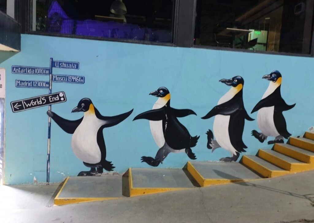
Route: Expect hilly terrain, technical descents, and some forest roads. This is one of the most scenic sections of the trip, with the final stretch offering views of the Beagle Channel.
Highlights: You’ll pass through Tierra del Fuego National Park, offering breathtaking views of mountains, forests, and the sea.
Evening: Arrive in Ushuaia, your destination, where you can explore the town, take a trip to Tierra del Fuego National Park, or even embark on a boat ride on the Beagle Channel.
Additional Tips
Weather: Expect unpredictable weather, including high winds, rain, and cold temperatures, especially in the Patagonian steppe. Always carry waterproof gear and warm layers.
Bike Setup: A full-suspension bike (for comfort on rough terrain) is recommended, along with plenty of spare parts, tools, and tire repair kits.
Preparation: Make sure to stock up on food and water before heading into remote stretches, as services are sparse.
Enjoy your adventure through one of the most breathtakingly remote and rugged parts of the world!


